As Mohamed Limo tends to his farm in Singida, Tanzania, there is a soft humming overhead. A drone is methodically circling the one-acre plot, taking detailed photos of the trees, shrubs, and crops covering his land.
The TREES team is taking drone imagery of Forest Gardens across sub-Saharan Africa to collect data on farmers’ progress and successes of the Forest Garden Approach.
Mohamed is part of Trees for the Future’s (TREES) Forest Garden training program. TREES trains farmers in a regenerative agroforestry technique called the Forest Garden Approach. Over the four-year training program, farmers learn to retore and protect their land. They are ultimately improving their land and livelihoods through thoughtful, sustainable land management.
A Global Drone Program
Back on the ground, Fortunatus Mwananjela is operating the drone. He is the Monitoring and Evaluation Coordinator for Trees for the Future (TREES) in Tanzania.
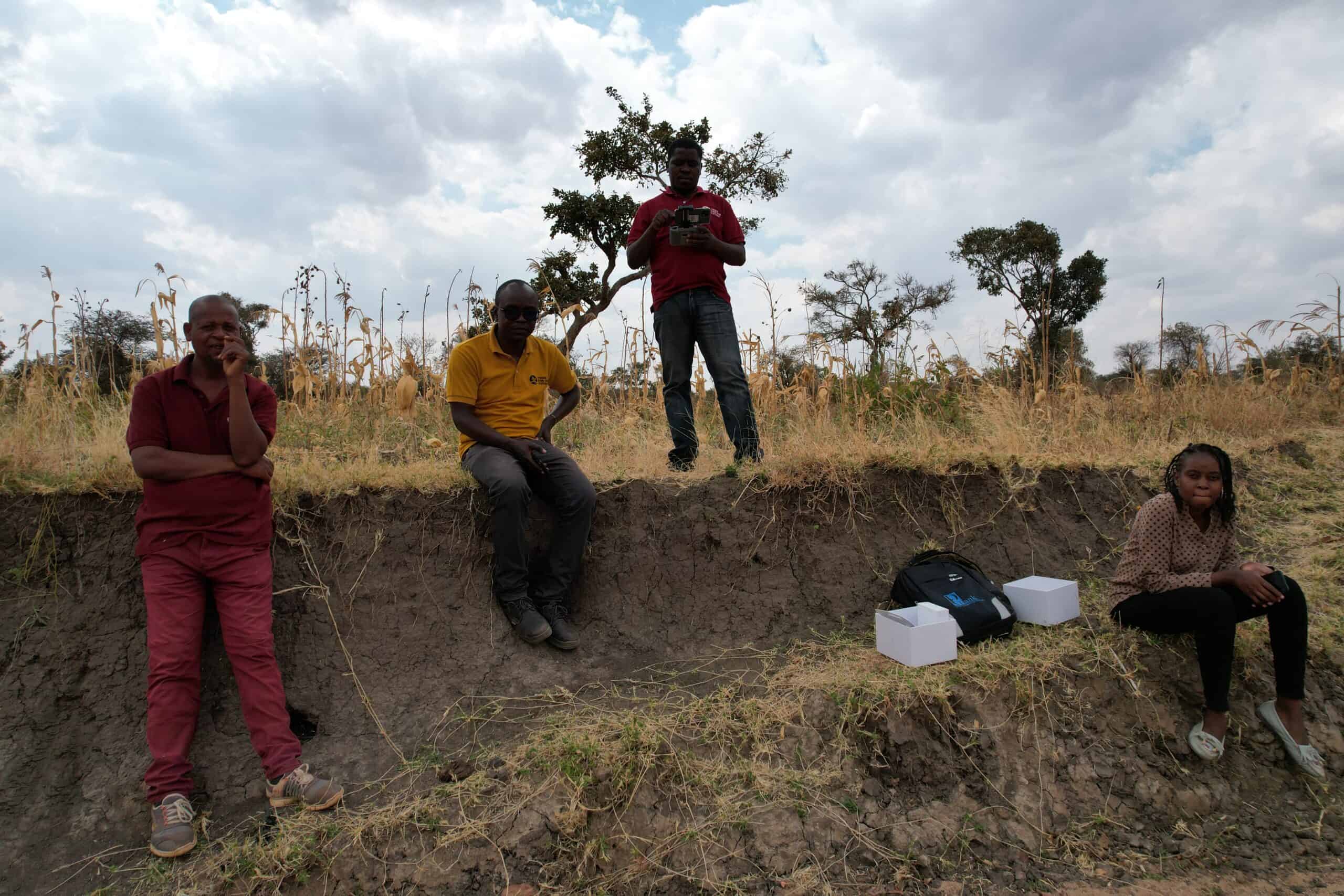
Monitoring and Evaluation Coordinator and Drone Pilot Fortunatus Mwananjela snaps a shot of himself (top center) and his team as a drone takes off in Singida, Tanzania.
“Our drone footage has simplified how to tell people the stories of the Forest Garden Approach,” says Mwananjela. “From this point of view, it’s easy to help people visualize the impacts we make around the world.”
TREES’ Monitoring, Evaluation, and Learning team first began collecting drone imagery of Forest Gardens in 2018. By 2022, TREES launched its drone program in every country of operation: Mali, Senegal, Kenya, Tanzania, and Uganda.
Monitoring, Evaluation, and Learning
“The data we are collecting using these drones provides valuable qualitative measurements and communication pieces,” explains Director of Monitoring, Evaluation, and Learning Andrew Zacharias.
TREES drones take roughly 200 photos on the average 20-minute flight over a Forest Garden.
TREES’ drone pilots take roughly 200 photos throughout the average 20-minute flight. Then, staff generate high-resolution orthomosaic images, 3-D models, and quantitative measurements of above-ground biomass (ABG) change and leaf area index (LAI). This gives Zacharias and his team the ability to see a more comprehensive picture of each Forest Garden than what is visible from the ground.
“We can see farmers progress through the program and identify objective successes and any opportunities for improvement in the program,” he says.
But it isn’t as simple as taking off and snapping a few pictures.
“To establish an effective monitoring and evaluation process, we are currently testing different measurement frequencies. We have selected a small number of Forest Gardens from the areas where operators are based. They’re visiting them during the rainy and dry seasons to determine the optimal data collection frequency.”
Zacharias adds that the team is currently perfecting the generating of orthomosaics and 3-D models. They plan to start measuring the ABG and LAI figures later in 2023.
The end result will be detailed images collected year after year that can provide an in-depth look at a Forest Garden in a given climate, how quickly tree cover and ABG is restored, and where farmers may need more support from TREES.
Seeing is Believing
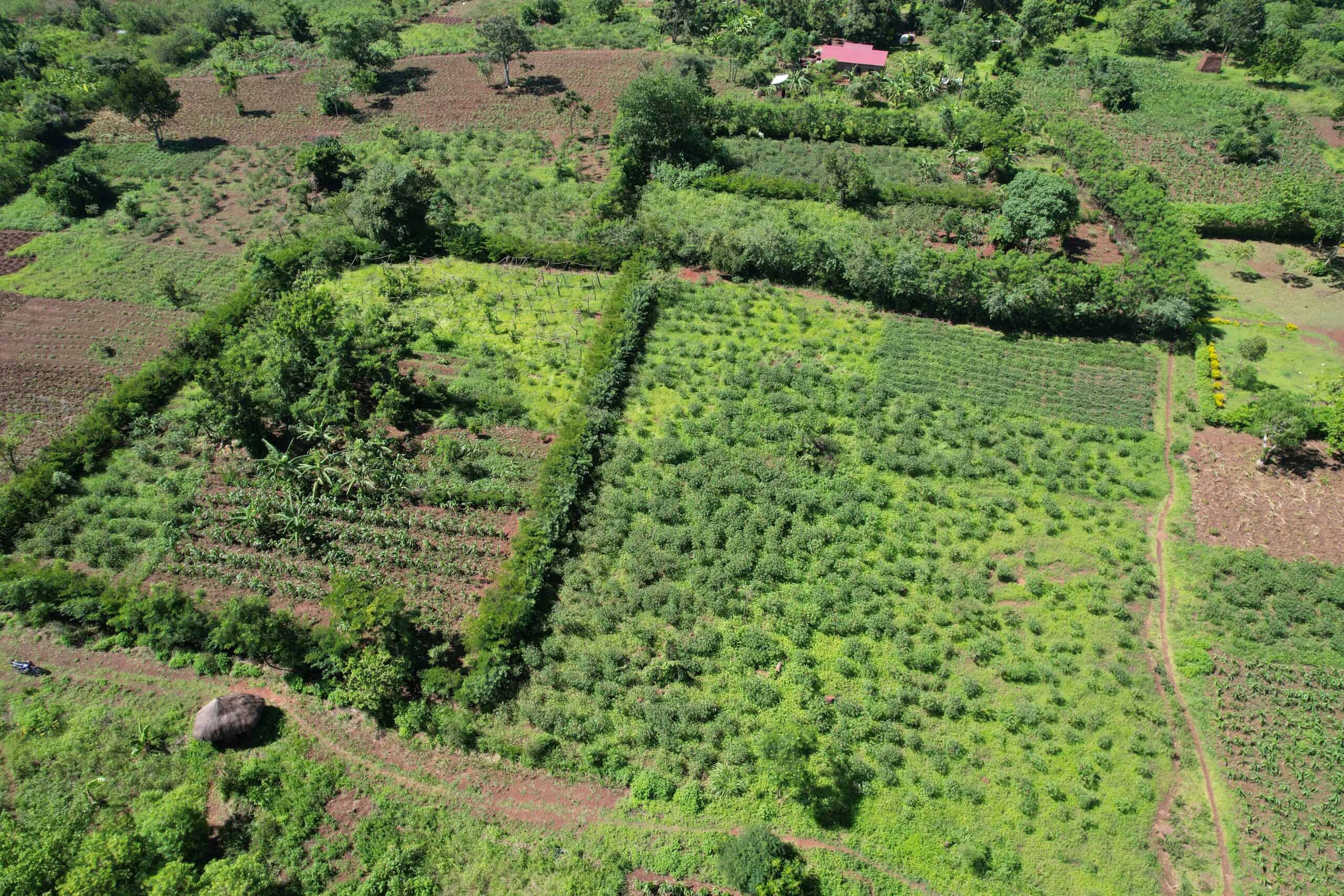
“The images we’ve already collected are incredibly powerful in conveying the difference between sustainable techniques like the Forest Garden Approach and the more traditional monocrop techniques you see in neighboring fields,” says Zacharias. “We’re really excited to see what more we can learn through this growing program.”
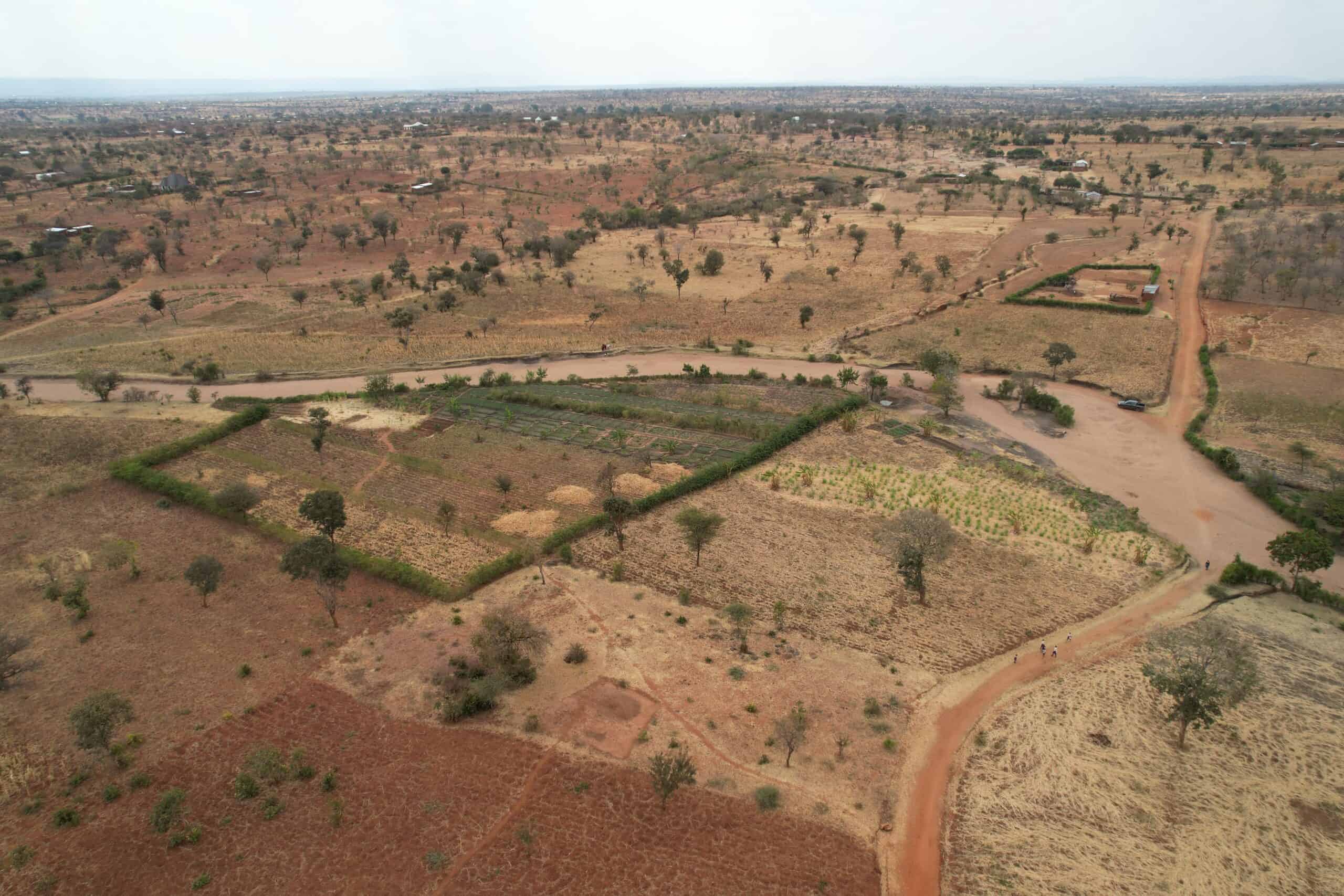
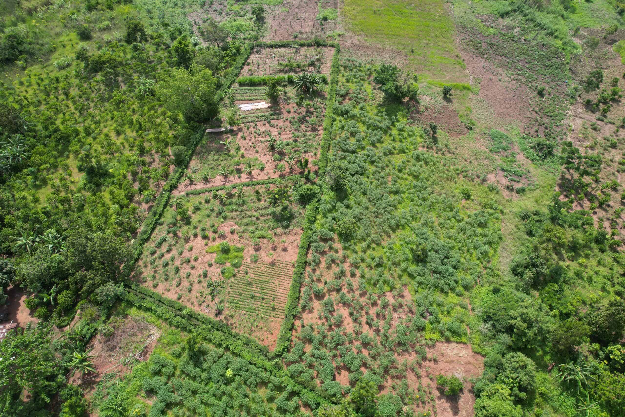
From a higher altitude, drone imagery shows two Forest Gardens protected by living fences. Neighboring fields have been harvested for the season. They are more susceptible to desertification and nutrient loss and will not turn a profit for those farmers until the next crop is planted and harvested.
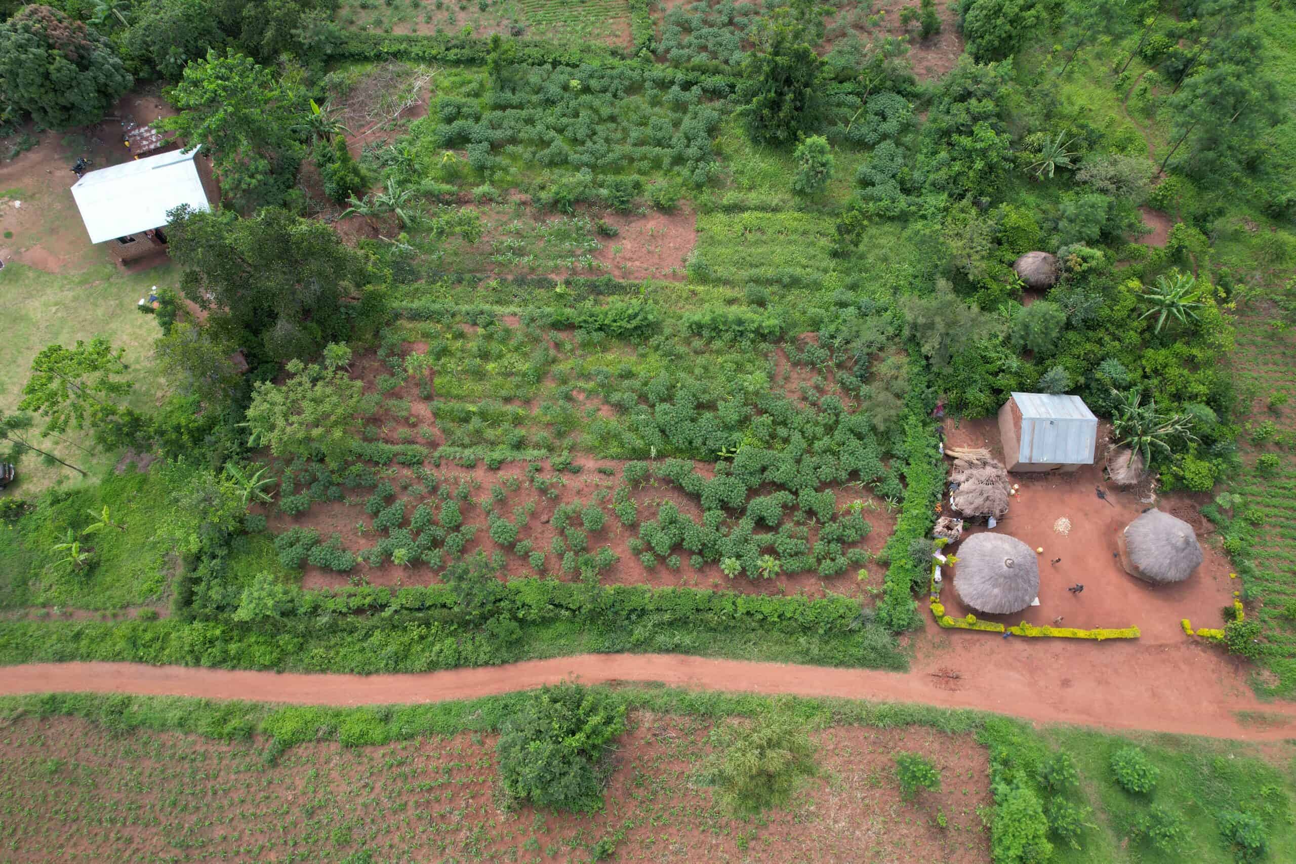
“The impact of our work is clearly seen when capturing images of things like the green cover,” adds Lydia Muyama, Monitoring and Evaluation Coordinator in Uganda. “The drone captures the surroundings and in most cases the difference is clearly seen.”
Monitoring and Evaluation Coordinator Lydia Muyama captured this shot of two neighboring Forest Gardens in Busia, Uganda.
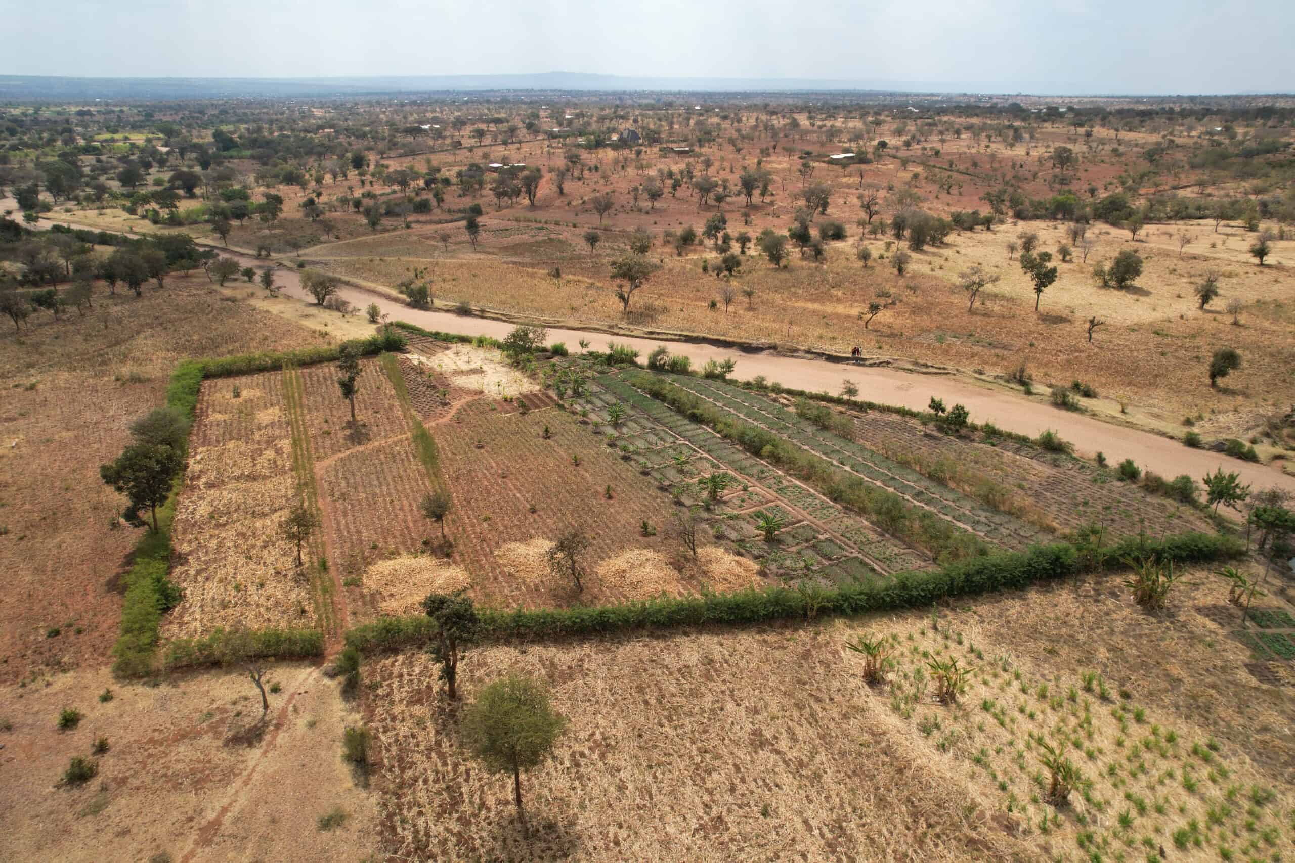
The striking difference is clear in the images taken at Mohamed’s farm too. The scars of a winding seasonal river can be seen eroding neighboring farms, but Mohamed’s Forest Garden is protected by the protective grasses and trees he has planted along the border. It’s something that Forest Garden farmers and TREES staff see every day, but for Mwananjela, the picture is worth a thousand words.
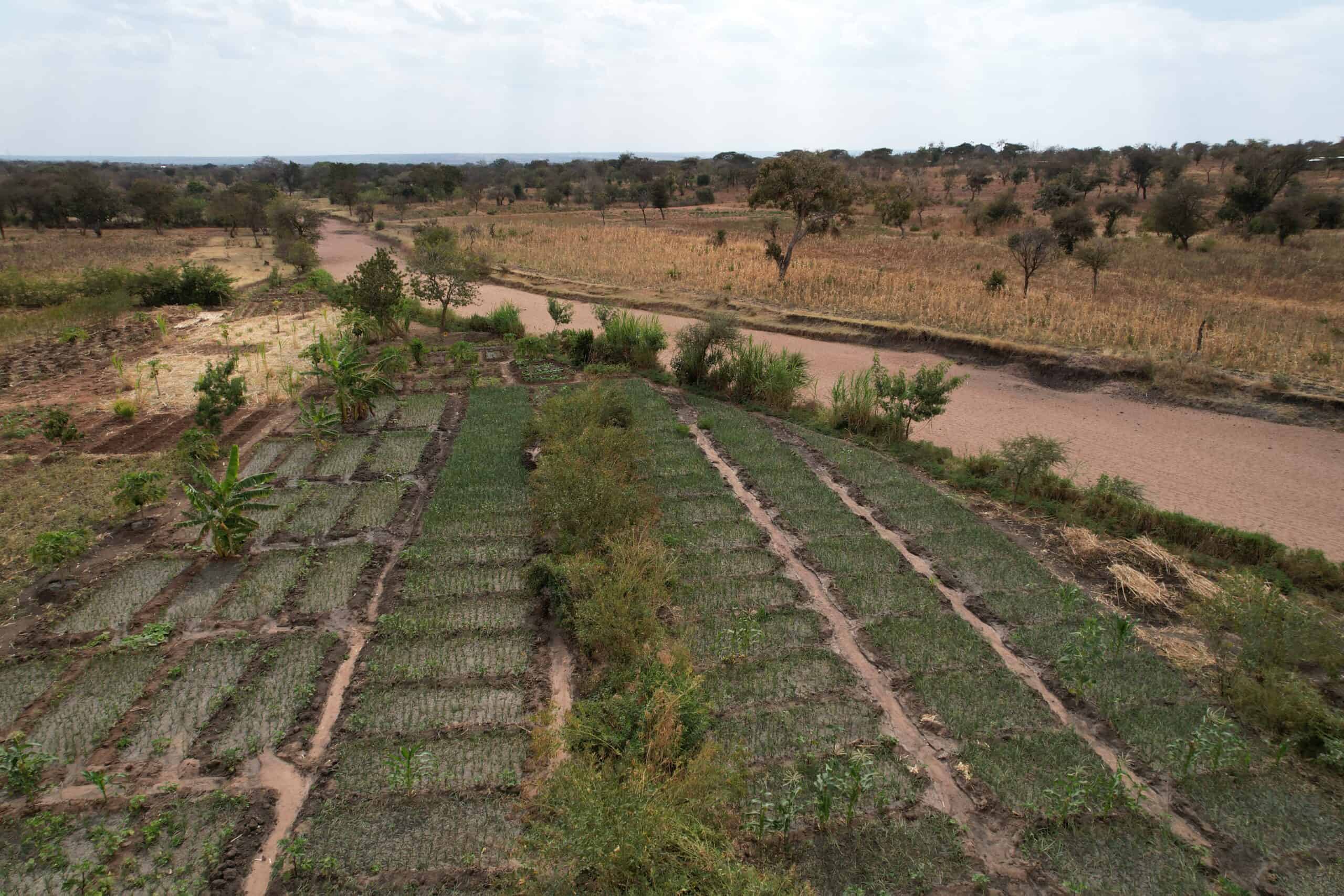
The seasonal river running along Mohamed’s Forest Garden is dry, but the damage from last season’s flow can be seen on the opposite bank. Mohamed protected his land from erosion and costly losses using techniques he learned from TREES.
“The drone footage shows that TREES lives the agroforestry approach. To see is to believe!”
Help TREES reach more farmers like Mohamed, donate today.